***Sorry Sold ***Vintage Framed Nova Totius Terrarum Orbis Geographica ac Hydrographica Tabula He
$35.00
Out of stock
SKU
A486
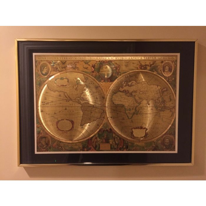
Nova Totius Terrarum Orbis Geographica ac Hydrographica Tabula vintage framed Heliography - Hendrik Hondius folder. By Manifestaions Inc.
Optical Illusion Print in Gold Foil. Framed in Gold (metal) frame with black matting, Glass front, Ready to hang.
Gold frame has few small scratches, no dents or dings. There is a tiny chip in the mat upper right corner. The whole measuring 17" high and 24" wide.
Wonderful framed Nova Totius Terrarum Orbis Geographica ac Hydrographica Tabula or Hendrik Hondius map.
Nova Totius Terrarum Orbis Geographica ac Hydrografica Tabula is a map of the world that was founded in 1630 by Hendrik Hondius and appeared the following year in Amsterdam, in the atlas Atlantis Maioris Appendix. Illustrations of the four elements of fire, air, water and land are included. In the four corners there are portraits of Julius Caesar, Claudius Ptolemy and the first two publishers of the atlas, Gerard Mercator and Jodocus Hondius, the father of Hendrik. [36] under its claims to notability is the fact that it is the first dated map published in an atlas, and thus the first many available map to show any part of Australia, the only previous map with this was, Hessel Gerritsz ' 1627 Caert van ' T Landt van d'Eendracht's, which was not widely distributed or recognized. The shown Australian coast is part of the west coast of Cape York Peninsula, discovered by Jan Carstensz in 1623. Specifically, the map does not show the west coast features in Gerritsz’s Caert.
Executed in a Heliography makes this a very particular copy, this is a special photographic reproduction method where one gets a golden appearance, depth perception and relief.
Write Your Own Review